Active Research Projects
Ice Sheet and Sea-Level History in Scotland
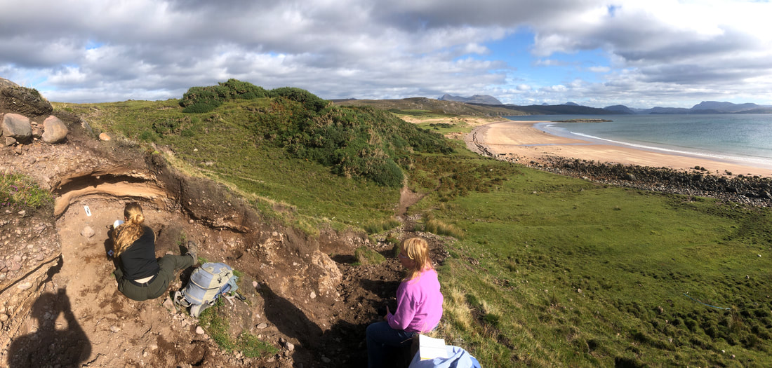
With colleagues at Durham University (UK), University of Glocestershire (UK), Stirling University (UK), Sheffield University (UK), East Carolina University, and the University of Michigan, we are examining the interactions between ice sheet behavior and relative sea level. In doing so we are examining the response of the Earth to the retreat of the Minch Ice Stream of NW Scotland during the early deglacial period.
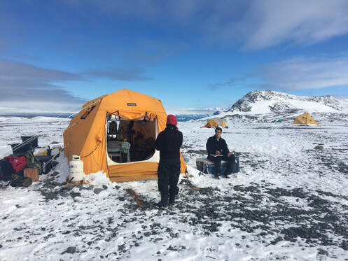
Antarctic Sea Levels
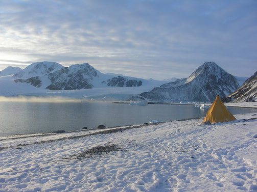
With colleagues at East Carolina University (Dr. Regina DeWitt), we have developed a new way to date raised beaches in Antarctica. We have used this data to reconstruct past sea levels across the Antarctic Peninsula and provide new insights related to the ice-sheet and climate history of the region.
|
|
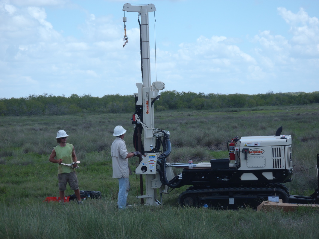
Coastal Evolution
|
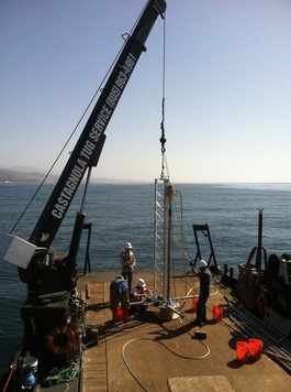
Coastal deposits, including estuaries, provide an ideal archive of past climate and tectonic events. We have taken cores in dozens of shallow water marshes, tidal flats, coastal lakes and bays across the Gulf of Mexico and California. From these deposits we have reconstructed past records of environmental change and extreme events.
|
Some Past Projects
Highstand Shelf Fans in the Santa Barbara Channel
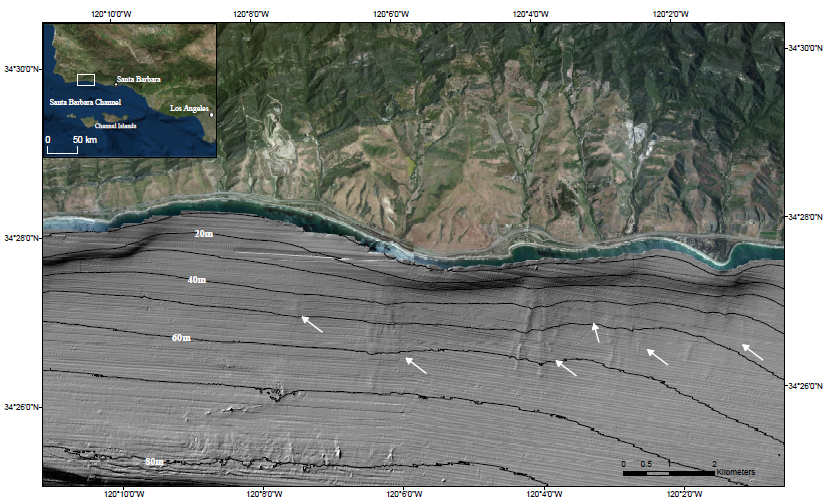
|
|
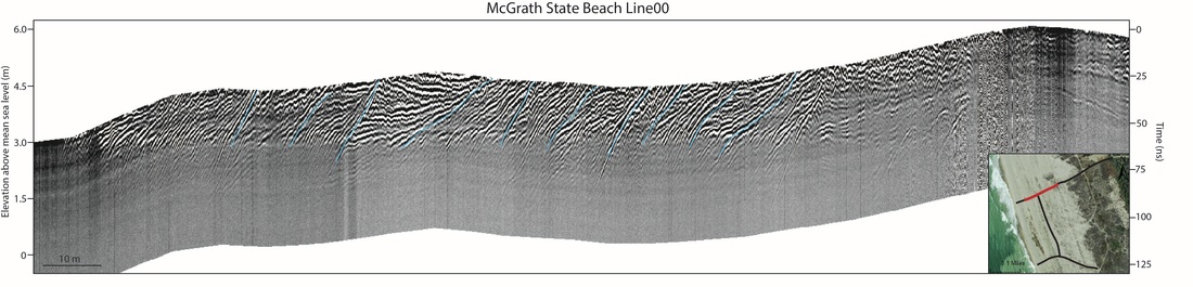
Late Quaternary relative sea level in Southern California and Monterey Bay
|
Few records of late Quaternary relative sea level (RSL) are available for the Pacific coast of North America south of San Francisco Bay, a region where RSL data would be particularly useful for constraining vertical rates of tectonic motion. This paper provides the first regional, uplift-corrected late Quaternary RSL history for southern California derived from a compilation of 132 previously published and unpublished radiocarbon ages from nearshore, estuarine, and freshwater deposits in sediment cores from coastal southern California. We also provide a local, uplift-corrected RSL history for Monterey Bay, central California, generated from 48 radiocarbon ages from Elkhorn Slough and surrounding environments. Our resulting compilations show rapid sea-level rise from 15 ka which begins to decelerate to present mean sea level (PMSL) between 6 and 8 ka. Late Holocene (<4 ka) sea-level rise averaged 0.8 ± 0.3 mm a−1 in southern California and 1.3 ± 0.19 mm a−1 along Monterey Bay in central California. Both rates of late Holocene RSL rise calculated are lower than recent RSL rates from southern California (∼1.61 ± 0.34 to 2.4 ± 1.04 mm a−1) and Monterey Bay (1.49 ± 0.95 mm a−1), derived from uplift-corrected, 20th century tide gauge data. This new RSL data fills geographical gaps in relative sea-level histories, as well as provides important datums for local tectonic processes.
|
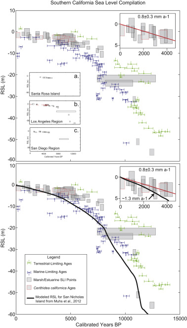
(Reynolds and Simms, 2015: 10.1016/j.quascirev.2015.08.003)
|
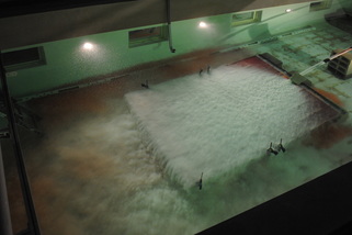
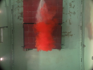
Turbidity Currents with Reversing Buoyancy
|
|
Contrasts between the density of interstitial fluid within a turbidity current and the density of ambient fluid through which the current is traveling result in changes in the overall morphology of turbidites. This series of flume experiments explores the evolution of turbidity currents with relatively light interstitial fluid and the ways in which buoyancy reversal, or lofting, effects the overall geometry of submarine fans.
|
Ground-Penetrating Radar: Dinstinguishing Wave-Dominated Deltas from Prograding Clastic Shorelines
|
Ground-penetrating radar (GPR) profiles from the Ventura-Oxnard Coastal Plain in southern California provide insight into processes governing the deposition of sediments proximal to wave-dominated deltas. Both wave-dominated deltas and prograding clastic shorelines exhibit similar characteristics, making distinguishing them in outcrops with limited exposure a difficult task. However, one process that may be unique to wave-dominated deltas is the welding of offshore bars that have formed after large floods along the delta, onto the shoreline. This process forms landward dipping sediments that we have imaged in GPR profiles. Cores taken along the GPR profiles will provide sediments that can be dated using optically stimulated luminescence to match these bar-welding events to historical local storms in order to confirm their origin. The ability to identify different depositional environments enhances the understanding of facies architecture and depositional processes occurring along shorelines.
|
|